 Catalogue PIGMA
/Human activities/Aquaculture
Type of resources
Topics
Keywords
Contact for the resource
Provided by
Years
Formats
Representation types
Scale
-

The project’s purpose is to introduce new low trophic species, products and processes in marine aquaculture value chains across the Atlantic. Low trophic species are those organisms low on the food chain as sea urchins or mussels. The five chosen value chains of AquaVitaeinclude macroalgae, Integrated Multi-Trophic Aquaculture (IMTA), echinoderm species (e.g. sea urchins), shellfish and finfish. IMTA is a process that farms several species together using waste from one species as feed for another. One of the main expected results of the project would be the creation of real and meaningful collaborative links between researchers, industry and other aquaculture stakeholders in the Atlantic area. AquaVitae will contribute to the Belém Statement, the joint Declaration on Atlantic Ocean Research and Innovation Cooperation between the European Union, Brazil, and South Africa through: - Setting up a network for knowledge and research exchange through the Atlantic. - Sustainable use of marine resources with a circular economy approach. - Better monitoring of aquaculture activities through new and emerging technologies. - Contributing to the well-being of aquaculture communities. - Enhancing citizen engagement through training and outreach activities. - Setting up student exchanges and industrial apprenticeships.
-
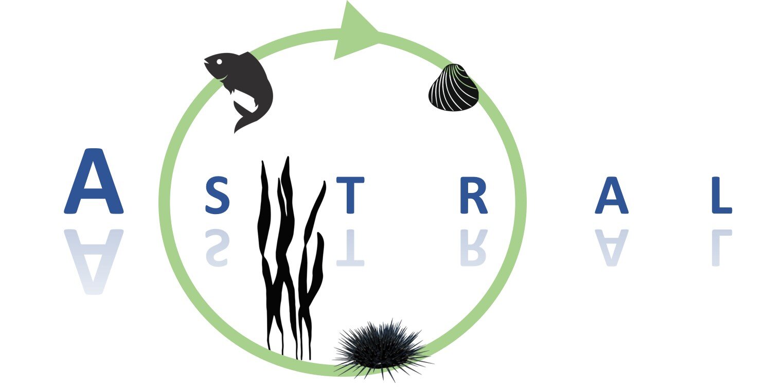
In integrated multi-trophic aquaculture (IMTA), multiple aquatic species from different trophic levels are farmed together. Thus, waste from one species can be used as input (fertiliser and food) for another species. The EU-funded ASTRAL project will develop IMTA production chains for the Atlantic markets. Focusing on a regional challenge-based perspective, it will bring together labs in Ireland and Scotland (open offshore labs), South Africa (flow-through inshore) and Brazil (recirculation inshore) as well as Argentina (prospective IMTA lab). The aim is to increase circularity by as much as 60 % compared to monoculture baseline aquaculture and to boost revenue diversification for aquaculture producers. ASTRAL will share, integrate, and co-generate knowledge, technology and best practices fostering a collaborative ecosystem along the Atlantic.
-
Explore global fisheries and aquaculture. Understand their status and how impacts are being managed. Learn what improvements are underway, and see what actions seafood stakeholders can take to drive sustainability. FishSource is a publicly available online resource about the status of fisheries, fish stocks, and aquaculture. FishSource compiles and summarizes publicly available scientific and technical information and presents it in an easily interpretable form. FishSource was created in 2007 by Sustainable Fisheries Partnership to provide major seafood buyers with up-to-date, impartial, and actionable information on the sustainability of fisheries and the improvements they need to make to become more sustainable. In 2018, information on aquaculture sources was added to the database to provide FishSource users with a more robust tool that covers all types of seafood production. Although the primary intended audience of FishSource is seafood businesses, other audiences - such as academics, researchers, and non-profit organizations - have also become frequent and welcomed users of FishSource. The information on FishSource is primarily developed and updated by a small team of in-house analysts, but their capacity is recognizably insufficient to maintain complete coverage of all global fisheries. As such, profiles may be incomplete or information may be out of date. The seafood industry and external contributors are invited to help fill any gaps that they consider priorities through our Rapid Assessment Program. FishSource always welcome comments on any of our profiles and encourage an open debate on the sources of information used and our interpretation of the data. Our objective is to use only publicly available sources and fully credit those sources, effectively acting as an inventory of information sources on fisheries and aquaculture.
-
The CWP, supported by the participating organizations, serves as the premier international and interorganizational forum for agreeing common definitions, classifications and standards for the collection of fishery and aquaculture statistics. It has developed common procedures for statistics collation which have streamlined processes and reduced the burden on the statistical offices of national fisheries and aquaculture production, as well as providing technical advice to participating organizations on fishery-related and aquaculture-related statistical matters, and facilitating the publication of methodological and reference documents. The Coordinating Working Party on Fishery Statistics (CWP) provides a mechanism to coordinate the statistical programmes conducted by regional fishery bodies and other intergovernmental organizations with a remit for fishery statistics. Main function: - To continually review fishery statistics requirements for research, policy-making and management; - To agree on standard concepts, definitions, classifications and methodologies for the collection and collation of fishery statistics; - To submit proposals for the coordination and streamlining of statistical activities among the relevant intergovernmental organizations.
-
OSPAR is the mechanism by which 15 Governments & the EU cooperate to protect the marine environment of the North-East Atlantic. OSPAR started in 1972 with the Oslo Convention against dumping and was broadened to cover land-based sources of marine pollution and the offshore industry by the Paris Convention of 1974. These two conventions were unified, up-dated and extended by the 1992 OSPAR Convention. The new annex on biodiversity and ecosystems was adopted in 1998 to cover non-polluting human activities that can adversely affect the sea. The fifteen Governments are Belgium, Denmark, Finland, France, Germany, Iceland, Ireland, Luxembourg, The Netherlands, Norway, Portugal, Spain, Sweden, Switzerland and United Kingdom. OSPAR is so named because of the original Oslo and Paris Conventions ("OS" for Oslo and "PAR" for Paris). OSPAR Data & Information Management System (ODIMS) is a fully featured platform for accessing OSPAR's geospatial maps, data and metadata. 61 Maps and 254 layers regarding: - Cables and pipelines - Comprehensive atmospheric monitoring programme - Discharges of radionuclides from the non-nuclear sectors - Discharges, spills and emissions from offshore oil and gas installations - Dumping and placement of wastes or other matter at sea - Environmental monitoring of radioactive substances - Fishing for litter - Vulnerable marine ecosystems - etc.
-
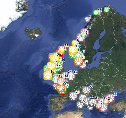
This dataset stems from the Joint Research Centre (JRC) Biomass Mandate (https://knowledge4policy.ec.europa.eu/projects-activities/jrc-biomass-mandate_en) and it is available for viewing and download on EMODnet - Human Activities web portal (www.emodnet-humanactivities.eu) and on the platform from the European Commission’s Knowledge Centre for Bioeconomy (https://knowledge4policy.ec.europa.eu/visualisation/bioeconomy-different-countries_en#algae_prod_plants). Its aim is to build a reliable database to characterize the algae sector and to support informed European policies on Blue Growth and Bioeconomy. More detailed information on the Status of the Algae Production Industry in Europe can be found in a JRC-led study published in Frontiers in Marine Science (https://publications.jrc.ec.europa.eu/repository/handle/JRC122250). Information on the location (geographic coordinates) of the production facilities, group of produced organism (macroalgae, microalgae and spirulina), production method (Fermenters, Harvesting , Photobioreactors, Open ponds, Semi Open ponds, land-based or at sea Aquaculture, Integrated multi-trophic or not) and species (see dataset) have been collected in the following countries: Austria, Belgium, Bulgaria, Croatia, Czech Republic, Denmark, Estonia, Faroe Islands, France, Germany, Greece, Greenland, Hungary, Iceland, Ireland, Italy, Latvia, the Netherlands, Norway, Portugal, Spain, Sweden, Switzerland and the UK. In November 2021, the JRC has updated the database with the latest information on the production units operational at the time.
-
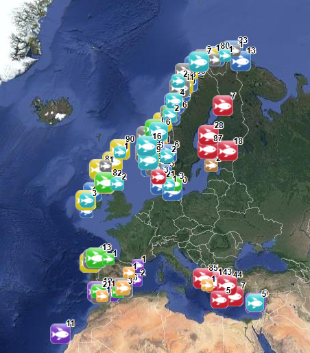
The database on marine finfish aquaculture in the EU was created in 2017 by AND-International for the European Marine Observation and Data Network (EMODnet). The dataset provides information about the location of marine finfish farms in the EU and partner countries where data are available. There is an obligation for EU MS to inventory all authorized aquaculture sites under the Council Directive 2006/88/EC on animal health requirements. Despite this obligation, the availability of data varies among MS from no data available at all to a complete regularly updated dataset (e.g.in Ireland). As far as partner countries are concerned, data have been collected only in Norway and the UK (Scotland only) at this stage, where detailed data are provided online. Data provided here cover Cyprus, Danmark, Finland, Greece, Ireland, Malta, Norway, Spain and the UK (Scotland only). Data collection is still undergoing in other EU MS and neighbouring countries. Each point has the following attributes (where available): Country, Owner name, Status (Active, Expired, Inactive, Renewal, n.a.), Farm type (Flatfish, Diversified farm, Other specialised farm, Salmon, Salmonids, Seabass-seabream, Trout,Tuna, n.a.), Production method (Sea cages, Saltwater tanks/raceways, Saltwater ponds, Saltwater closed (recirculation), Quarantine, Other, n.a.), Production stage (Grow out for human consumption, Hatchery, Nursery, Brood stock, Reproduction, Restoration of wild stock, Put and take fisheries, Processing facility, Salughtering facility, Other, n.a.), Purpose (Commercial, Restocking, Other, n.a.), Products detailed (detailed product information names as presented in the source and translated to English), Point information (Polygon centroid, Original) depending on how the information is provided in the source (polygons or points), Site_ID. The farm type relies on a typology established by AND-International, based on available information on species grown. A relational table provides harmonised information about species grown using Eurostat nomenclature for the Species Group (Cods, hakes, haddocks; Flounders, halibuts, soles; Miscellaneous coastal fishes, Miscellaneous demersal fishes; Miscellaneous pelagic fishes; Salmons, trouts, smelts;Tunas, bonitos, billfishes), the species name (commercial and scientific) and the code. Compared with the previous version this new version has been not only updated but was also reviewed (dataset schema and attributes values), in order to add information on production methods, production stages and purposes and to provide a more useful typology based on species grown.
-
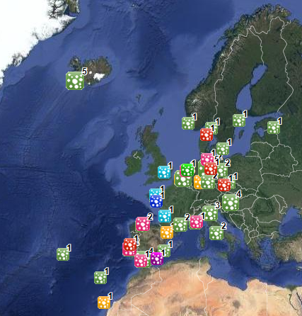
The database on shellfish aquaculture in the EU was created in 2014 by AND-International for the European Marine Observation and Data Network (EMODnet). It is the result of the aggregation and harmonization of datasets provided by national sources across the EU (plus Norway) and by the project Euroshell. Data are available for viewing and download on EMODnet - Human Activities web portal (www.emodnet-humanactivities.eu). The database contains points representing shellfish farms or shellfish production areas (depending on available data) in the following countries: Bulgaria, Denmark, France, Greece, Ireland, Italy, Netherlands, Norway and United Kingdom. Spanish data is provided separately through WMS services. Data is missing for Germany, Portugal, Sweden, Croatia and Slovenia. Except for Germany, the shellfish production remains limited in those MS. There is no production in other MS. Each point has the following attributes (where available): status (active, inactive), country, owner name, farm type (Mussels, Oysters, Mussels-Oysters, Clams, Specialised (other), Mixed (other)), production method (Long lines, Trestles or trays, Tanks, Rafts, Beds, Raceways), production stage (Grow out for human consumption, Hatchery, Nursery, Broodstock, Reproduction, Harvest, Other), purpose (Commercial, Research, Education, Display, Other), species detailed (English translation of the information provided on species grown or authorised in the source), point information (Polygon centroid, Original) depending on how the information is provided in the source (polygons or points), site_id, distance to coast (metres), position from coastline (At sea, within the coastline). The farm type relies on a typology established by AND-International, based on available information on species grown or authorised. A relational table provides harmonised information about species grown or authorised using Eurostat nomenclature for the Species Group (Mussels; Oysters; Clams, cockles, arkshells; Scallops, pectens; Abalones, winkles, conchs; Sea-urchins and other echinoderms) and when available the species name (e.g. Blue mussels - Mytilus edulis). The distance to coast (EEA coastline shapefile) has been calculated using the original data map projections, where available. In the other cases it was used the UTM WGS84 Zone projected coordinate system where data fall in. Compared with the previous version this new version has been not only updated but was also reviewed (dataset schema and attributes values), in order to add information on production methods, production stages and purposes and to provide a more useful typology based on species grown. Data from Norway and Bulgaria have been added. Data from France relies on cadastral data rather than large production areas in the previous database.
-
The World Bank Group works in every major area of development. It provides a wide array of financial products and technical assistance, and it helps countries share and apply innovative knowledge and solutions to the challenges they face.